Monday, August 22, 2016

Back to the Rockies - Mt. Temple, Heart Mountain

Some time ago, Dr. Wade Abbott,  at the University of Lethbridge invited me to be the external examiner on one of his master's students thesis committee, and to give a talk about my research. Wade is an old colleague of mine, we both did our PhDs at the University of Victoria, and I have always been an admirer of his research. It's a great honour to have been invited, and as an added bonus, I was able to fly into Calgary the weekend right before the defence to climb a couple of mountains in the Rockies. Lucky me, two times in the Rockies this year!

Since I was going solo, I was relegated to non-technical ascents, so set my sights on climbing Mt. Temple (11,624') one of the tallest and most impressive mountains in the Canadian rockies.


The magnificent Mt. Temple
Although there are some amazing technical routes up the mountain (anyone want to climb them with me?) there is a moderate 3rd class scramble up the backside of the mountain.


The route up Mt. Temple - Courtesy Parks Canada
I woke up around 5 wolfed down some food and coffee, then drove to Lake Louise and the Trail head.  The trail starts at the picturesque Moirane Lake, and then heads up a series of 13 relatively gentle switchback to reach Larch valley


Early morning start at Moirane lake

Note to self -watch out for Grizzly bears. 

The switchbacks were fairly boring, but once into Larch valley there were some nice views of the "10 peaks" as well as Sentinel peak and my objective, Mt. Temple.


Larch valley
Sentinel Peak
I was passed by some ultra-runners, who were running up the mountain (dang) and then after the nice gentle larch valley, I began ascending Sentinel pass, and then onto the ridge of Mt. Temple


Sentinel pass. The route up Mt Temple on the right ridge line.
Once on top of the pass, it was thousands of feet of loose scree up the ridge side. Oh my. Although the scree was tedious, the views made up for it. This place is truly magnificent. 


Ascending scree slopes
Looking back down on Larch Valley
Typical rockies scenery.
After taking a wrong turn (who gets lost on a ridge? Me apparently) and climbing a 5 meter 3rd class step (the crux), and much more scree I eventually reached the summit ridge line. It also got very cold, a Northern wind picked up, and the layers came out of the backpack. 


Approaching the summit ridge line
The summit itself had a giant snow cornice. Horray, the top of Mt. Temple! What an amazing climb (hike, really) with spectacular views. 


Summit selfie - the lowest form of photography.

Spectacular summit ridge

Summit cornice

Then back down, through the hordes of people coming up (it really pays to start early, and be first on the summit!). Just under 6 hours car-to-car. ~5200' elevation gain, 10 miles. Not a speed record, but not slow. Probably would have been about 30 min faster if I had not gotten lost on route!

For day 2, I needed to get to Lethbridge, so I wanted something fast, that I could ascend in the morning, and be in Lethbridge by the afternoon. So I consulted the bible of Canadian Rockies Scrambling to find an objective. 


Scrambling bible. I wish the Sierras had one of these
I chose Heart Mountain, just outside of Canmore. It was short, only 3000' of elevation gain, so should only take a couple of hours. I slept in until 7, drove to the trailhead. I did a quick warm-up first, and ran the Hear creek canyon trail ( 3 miles) before heading up the mountain.


Got it. hand and feet.
The route ascends a ridge line, again a hiking trail, with just short bouts of really easy class 2+/3. Yet somehow I got off route, and ended ascending a 3rd class gully beside the stupid ridge! On the plus side this brought me to the second summit of Heart mountain, which is actually the higher summit. I traversed the ridge line, went back to the north summit, then descended the correct ridge route. Almost like I had done it on purpose. I think I need to work on my route finding skills, or at least follow the instructions in the guidebook, instead of ignoring them.


Views on the ascent of Heart Mountain

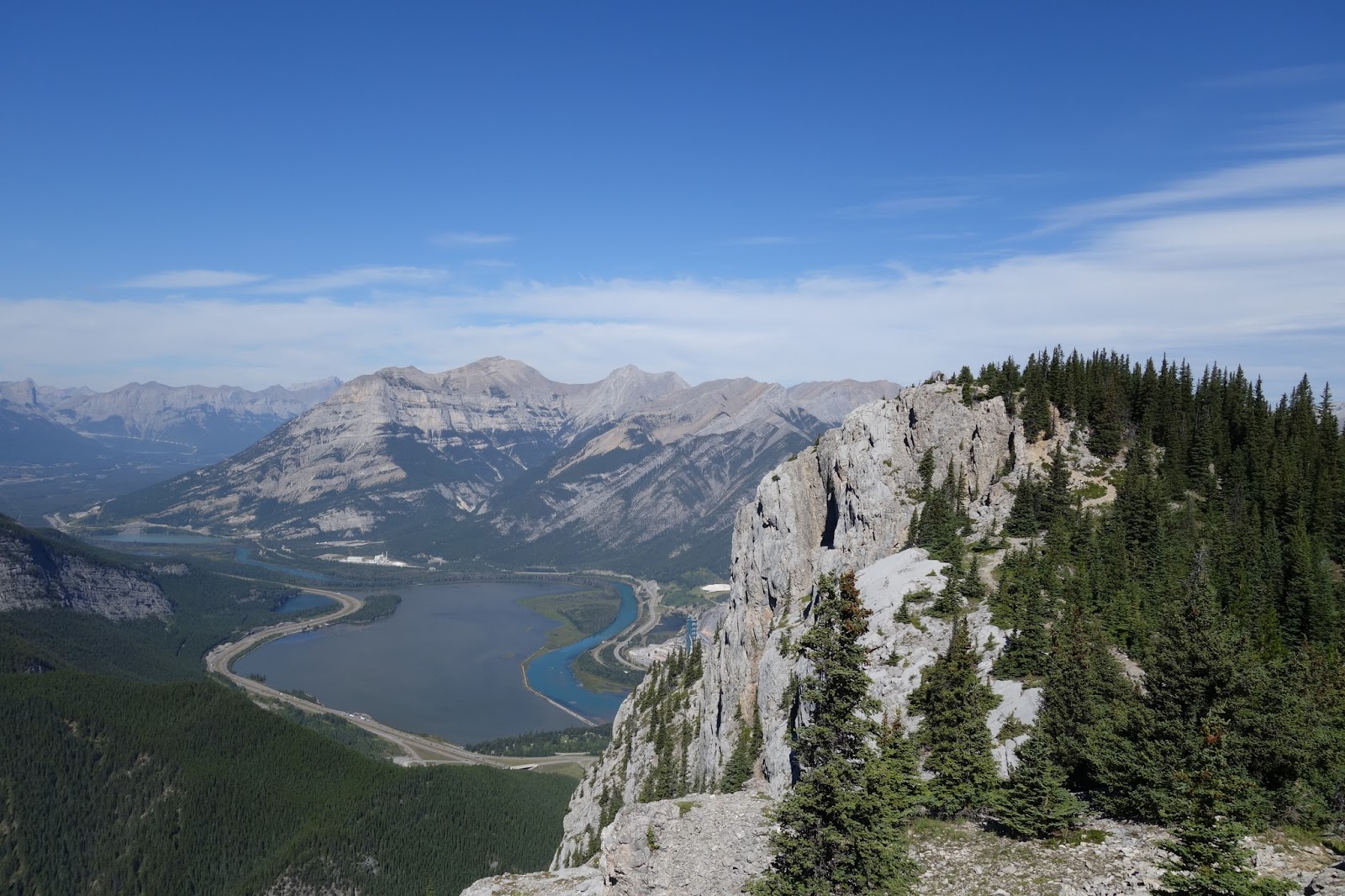
Looking back at the (false) North summit of Heart Mountain and the Bow valley.


Another low point in photography. Summit selfie. I need to learn how to use the timer.
The back down to the car, and the long drive to Lethbridge. Car-to-car with the trail run ~ 3 hours. Fun jaunt, not super exciting, but a good way to stretch the legs.

Then off to Lethbridge. It was terrific to see Wade again, he is doing very well. Its very satisfying to see old colleagues and friends doing so well in their professional lives. Wade has a strong, interesting research program and I was very impressed by what he has accomplished. 


A great trip, both climbing wise, and professionally. A great way to end my summer. 

No comments:

Post a Comment