Sunday, August 28, 2016

Matthes Crest - Type I fun

"The best climber in the world is the one having the most fun"
- Alex Lowe

If Alex was right, Michael Putnam and I were the best climbers in the world on Saturday. 

What we climbed can only be described as a delightful adventure in the mountains. It was certainly in my top 5 for favourite climbs of all time!

Matthes Crest - A delightful adventure in the mountains
Despite having just gotten back from the Rockies, and having just started teaching a new semester at the University, I found myself heading back into the mountains again. Michael Putnam, had the weekend off, since he works retail that does not happen very often, so I agreed to head up into the mountains with him. 

We set our sights on Matthes Crest, something that has been on my tick list  for a longtime. Its a freestanding knife edge ridge, a very unusual formation, the route traverses a classic "sidewalk in the sky"


Matthes Crest - We traversed from the South to the North Summit, then descended the notch
Michael picked me up at 7:30 pm on Friday, then we headed out to Touolmne meadows. After some shenanigans trying to get a camp site, we ended up camping in a road side pullout on the road to Yosemite creek. We woke up bright and early, and were on the approach trail by 7am. We set a good pace and passed several parties who were also on their way to Matthes Crest. Along the way there were the standard stunning views of the High Sierra. 


Michael is psyched.


We hiked passed Cathedral peak. Looking awesome as always. 
We got to the base in a bout 2 hours, and as typical in rock climbing classics in the High Sierra, there were a bunch of people lined up to climb it, several on the climb, and a bunch of people arriving right after us.

We rested a bit, then I started leading next to 2 other parties on route. Good times. The start is a couple of pitches of 5.4 climbing. Steep but really easy. Actually pretty good rock. Because the climbing is so easy it was possible to climb next to other people on route. Which we did.


Crowded?


This is awesome
Once on route, one of the themes of this trip became apparent, I was going to run into a lot of climbers that I knew, recognized, or knew by reputation. I think it goes to show that the climbing community is not as big as it sometimes seems.

First, on the approach, we ran into a group of 4 climbers from our local climbing gym, Metalmark, then when I got the first bely, I saw I bearded face I recognized from Troy's facebooks posts, Mitchell Quiring. Very friendly affable guy, with a passion for the mountains. 


Mitchell, nice to meet you! We need to climb some mountain together!

After the short headwall, it was onto the ridge proper. My face was a grin, and it continued grinning for hours on end. Such a cool route, 0.5 mile of ridge climbing.

Ridge climbing at its finnest
Michael and I simul-climbed the ridge, we probably could have soloed, but we though it was good practice to simul.

Cool ridge

Michael short-rope
Michael travelling some cool looking terrain
As we approached the south summit, the ridge became more exposed, and technical so we did short bits of mini-pitched climbing through the tricky sections

On one section of the ridge, some soloists passed us, and they turned out to be Richard, his friend Devin, and his girlfriend Laruen. Richard and I have done a few peaks together including Mt Morrison, Mt Langley, and Mt. Shasta. Small world. We chatted for a few minutes, then continued on. 

Michael looking suave with his kiwi coil
Once we were close to the south summit we got a view of some dudes on a highline stretching between the North and South summits. Very badass, and defiantly not something I would be comfortable doing! Good for them! 

Highline madness. That takes a calm head.

Whoa!
We down climbed to the notch and then headed up to the North Summit. It was supposed to be a 5.7, but since we did not consult the topo, Michael ended up leading the 5.8 off-width variation. A bit gnarly, and a bit burly. Good on Michael for leading that one, I think I might have cried like a baby and hung on some gear if I was leading. But of course, being a rope gun, he just crushed it.

This feels harder than 5.7....
Then the summit! Whoop! We sat for a few minutes and enjoyed the views of the ridge, watched the bottlenecked hordes near the south summit. I'm glad we didn't get stuck in that!

Life really is great, right Michael?

Such a cool climb

Fun day. But I am dehydrated an tired. 
We were both dehydrated and tired, so rigging the rappel took way longer than it should have, but we managed. Then we rapped down the notch, and met up with Mitchell and his buddy. 

A long trek back to the cars, then my just reward, a nice cold beer from the cooler

Touolmne beer - victory is mine!
We then headed to the mobile at Tioga Pass with Mitchell and his buddy for some post-climb food.

Sweet. Mobile.

Vegetarian chilli. So nice after a day of climbing.
Overall, such a great climb. Really one of the best adventures you can have in High Sierra. The climbing was beautiful, fun and easy. But at the same time, the length, the exposure and the views make it classic. Truly one of my favourite routes to date. It was great to share the day with Michael, and to meet Mitchell on route. It was really cool to see so many Fresno climbers out there (we met yet another Metalmarker on the way down). 

I highly recommend this route to anyone who love climbing, the mountains and does not mind a long hike and a big day. 

Next weekend is my wedding anniversary, so we'll have to pick a nice mountain to climb to celebrate! 

Monday, August 22, 2016

Back to the Rockies - Mt. Temple, Heart Mountain

Some time ago, Dr. Wade Abbott,  at the University of Lethbridge invited me to be the external examiner on one of his master's students thesis committee, and to give a talk about my research. Wade is an old colleague of mine, we both did our PhDs at the University of Victoria, and I have always been an admirer of his research. It's a great honour to have been invited, and as an added bonus, I was able to fly into Calgary the weekend right before the defence to climb a couple of mountains in the Rockies. Lucky me, two times in the Rockies this year!

Since I was going solo, I was relegated to non-technical ascents, so set my sights on climbing Mt. Temple (11,624') one of the tallest and most impressive mountains in the Canadian rockies.


The magnificent Mt. Temple
Although there are some amazing technical routes up the mountain (anyone want to climb them with me?) there is a moderate 3rd class scramble up the backside of the mountain.


The route up Mt. Temple - Courtesy Parks Canada
I woke up around 5 wolfed down some food and coffee, then drove to Lake Louise and the Trail head.  The trail starts at the picturesque Moirane Lake, and then heads up a series of 13 relatively gentle switchback to reach Larch valley


Early morning start at Moirane lake

Note to self -watch out for Grizzly bears. 

The switchbacks were fairly boring, but once into Larch valley there were some nice views of the "10 peaks" as well as Sentinel peak and my objective, Mt. Temple.


Larch valley
Sentinel Peak
I was passed by some ultra-runners, who were running up the mountain (dang) and then after the nice gentle larch valley, I began ascending Sentinel pass, and then onto the ridge of Mt. Temple


Sentinel pass. The route up Mt Temple on the right ridge line.
Once on top of the pass, it was thousands of feet of loose scree up the ridge side. Oh my. Although the scree was tedious, the views made up for it. This place is truly magnificent. 


Ascending scree slopes
Looking back down on Larch Valley
Typical rockies scenery.
After taking a wrong turn (who gets lost on a ridge? Me apparently) and climbing a 5 meter 3rd class step (the crux), and much more scree I eventually reached the summit ridge line. It also got very cold, a Northern wind picked up, and the layers came out of the backpack. 


Approaching the summit ridge line
The summit itself had a giant snow cornice. Horray, the top of Mt. Temple! What an amazing climb (hike, really) with spectacular views. 


Summit selfie - the lowest form of photography.

Spectacular summit ridge

Summit cornice

Then back down, through the hordes of people coming up (it really pays to start early, and be first on the summit!). Just under 6 hours car-to-car. ~5200' elevation gain, 10 miles. Not a speed record, but not slow. Probably would have been about 30 min faster if I had not gotten lost on route!

For day 2, I needed to get to Lethbridge, so I wanted something fast, that I could ascend in the morning, and be in Lethbridge by the afternoon. So I consulted the bible of Canadian Rockies Scrambling to find an objective. 


Scrambling bible. I wish the Sierras had one of these
I chose Heart Mountain, just outside of Canmore. It was short, only 3000' of elevation gain, so should only take a couple of hours. I slept in until 7, drove to the trailhead. I did a quick warm-up first, and ran the Hear creek canyon trail ( 3 miles) before heading up the mountain.


Got it. hand and feet.
The route ascends a ridge line, again a hiking trail, with just short bouts of really easy class 2+/3. Yet somehow I got off route, and ended ascending a 3rd class gully beside the stupid ridge! On the plus side this brought me to the second summit of Heart mountain, which is actually the higher summit. I traversed the ridge line, went back to the north summit, then descended the correct ridge route. Almost like I had done it on purpose. I think I need to work on my route finding skills, or at least follow the instructions in the guidebook, instead of ignoring them.


Views on the ascent of Heart Mountain

Looking back at the (false) North summit of Heart Mountain and the Bow valley.


Another low point in photography. Summit selfie. I need to learn how to use the timer.
The back down to the car, and the long drive to Lethbridge. Car-to-car with the trail run ~ 3 hours. Fun jaunt, not super exciting, but a good way to stretch the legs.

Then off to Lethbridge. It was terrific to see Wade again, he is doing very well. Its very satisfying to see old colleagues and friends doing so well in their professional lives. Wade has a strong, interesting research program and I was very impressed by what he has accomplished. 


A great trip, both climbing wise, and professionally. A great way to end my summer. 

Monday, August 8, 2016

Climbing in the Canadian Rockies

Canadian Rockies - Alpine test ground

The Canadian Rockies are the real deal, loose shattered rock, snow, ice, bad weather, rock fall, avalanches, seracs, glaciers, cornices. Its got it all, its a training ground for alpinists. 

After our tour in the Bugaboos, we planned to spend a bit of time in the Rockies. We ended up only climbing 3 mountains, all 3 of them were spectacular, and each was different and interesting in their own way.

Once out of the Bugs we spent a day in Canmore, doing laundry, and recuperating. 

Kyle recuperates 
We stayed for a couple of nights at the Hostel Bear, this allowed us to shower (9 days with no shower for me before this...) and being equipped with a kitchen allowed for quick cooking in the morning.

Kitchen facilities. Nice.
After our rest day, the weather forecast was not looking so great, so we decided to hang up the harnesses, and do a non-technical scramble. That way if the weather was foul, we could simple walk back down and hit up the pub. There are a variety of peaks located very close to Canmore, and we decided to climb one of the "Three Sisters" a Canmore landmark. We chose the larger objectives, Big Sister (9,632'), about 4500' elevation gain from the low elevation trailhead. The scramble ascends the southwest slopes, and is a moderate class 3 affair.

Three Sisters. Big Sister on the Right. Photo Credit - chrishoff.com
There was very heavy cloud cover, so we could not actually see the mountain, and after some aborted starts, we found the correct trailhead (its not a marked trail).

Kyle near the start of the route.
After slogging up timbered slopes, we busted out onto a rocky ridge

Start of the ridge line
There was an easy 3rd class down climbing crux, some loose rock, more ridge, and then the summit! The clouds were swirling around,  sometimes it would clear, other times a near whiteout, but no rain.

Break in the clouds on the ridge

Cool views

Down climbing crux


Patriotic summit

Summit shot
We headed back down, enjoying the views.

Views on the way down
It was not long before we were back at the car. About 5 hours car-to-car. Not bad for a rest day. We headed back to Canmore, hit up the pub, and planned for our next day.

Our next objective, the NE face of Ha Ling Peak (III, 5.6). The climb ascends to the left of the prominent prow of Ha Ling, and involves 12 pitches of moderate climbing on "quality" rock. Kyle had actually climbed this route 10 years ago in a 16 hour mini epic.


Next climb - NE face of Ha Ling Peak

We had an early start, scrambled up some scree and found the base of the climb. The beginning was a scramble up some choss, before the pitched rope climbing began.


Up we go
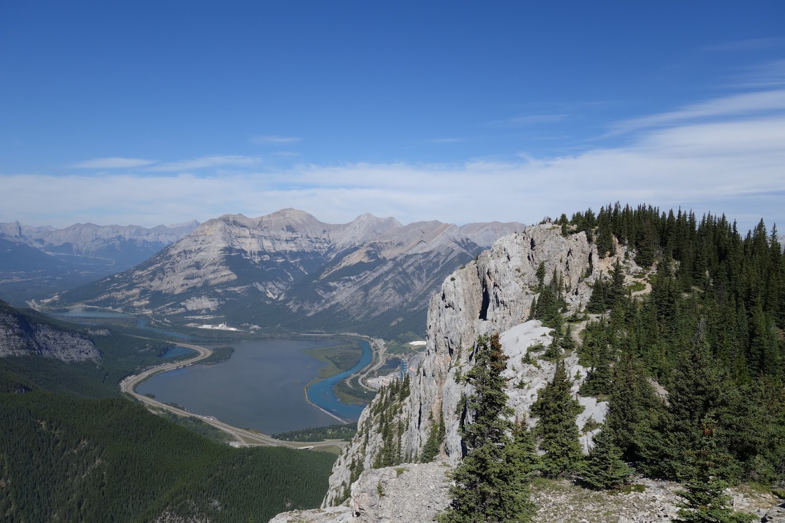
The climbing was actually pretty good, but you really needed to watch where you put your feet so not to send loose rock crashing down on parties climbing below us. The best pitch was a beautiful exposed dihedral, very nice. The view of the Bow valley from the climb were also not half-bad, and the weather was terrific.


High spirits on this one

Alpinist?

Up the delightful dihedral pitch

It was not long before we topped out the climb to a thong of tourists. The peak is a very popular walk-up, and there were hordes of tourists standing on top. They seemed a bit surprised with 2 rock climbers popped up from the steep cliff side of the mountain!


Another summit! 
We ran down the trail, and jogged back to the car. We stopped to say hello to the mountain goat. We made really good time, just 6 hours car-to-car. Not bad for 12 pitches of technical climbing (~1500'), a hour long approach, and lengthy descent. 


Good time
Hi goat!
Then back to Canmore, and you guessed it, a pub. Its really nice climbing out of Canmore, a bit like being in Bishop, easy access mountains, only 15-20 min of driving and you are at the base of 2000' faces!

To continue sampling the mountains, the next day we headed north. Originally we had planned to climb the North Face of Mt. Athabasca. However, while we were in the Bugs we discussed our plans with alpinist and guide Barry Blanchard and he told us that with global warming and glacier retreat, the North face had become "real".  

We drove by it on our way North, and decided to leave it for another trip. We continued further north to Jasper National park


We'll climb you next time Mt. Athabasca. Unless global warming has killed all your glaciers
We landed in Jasper, took a rest day, then had an aborted alpine start because of some rain. We entertained ourselves at camp with pointless contests (who can land the car bumber 1st, Kyle nabbed the FA on that one).


I didn't get the FA on this one


This is how the Brooks brothers do climbing trips

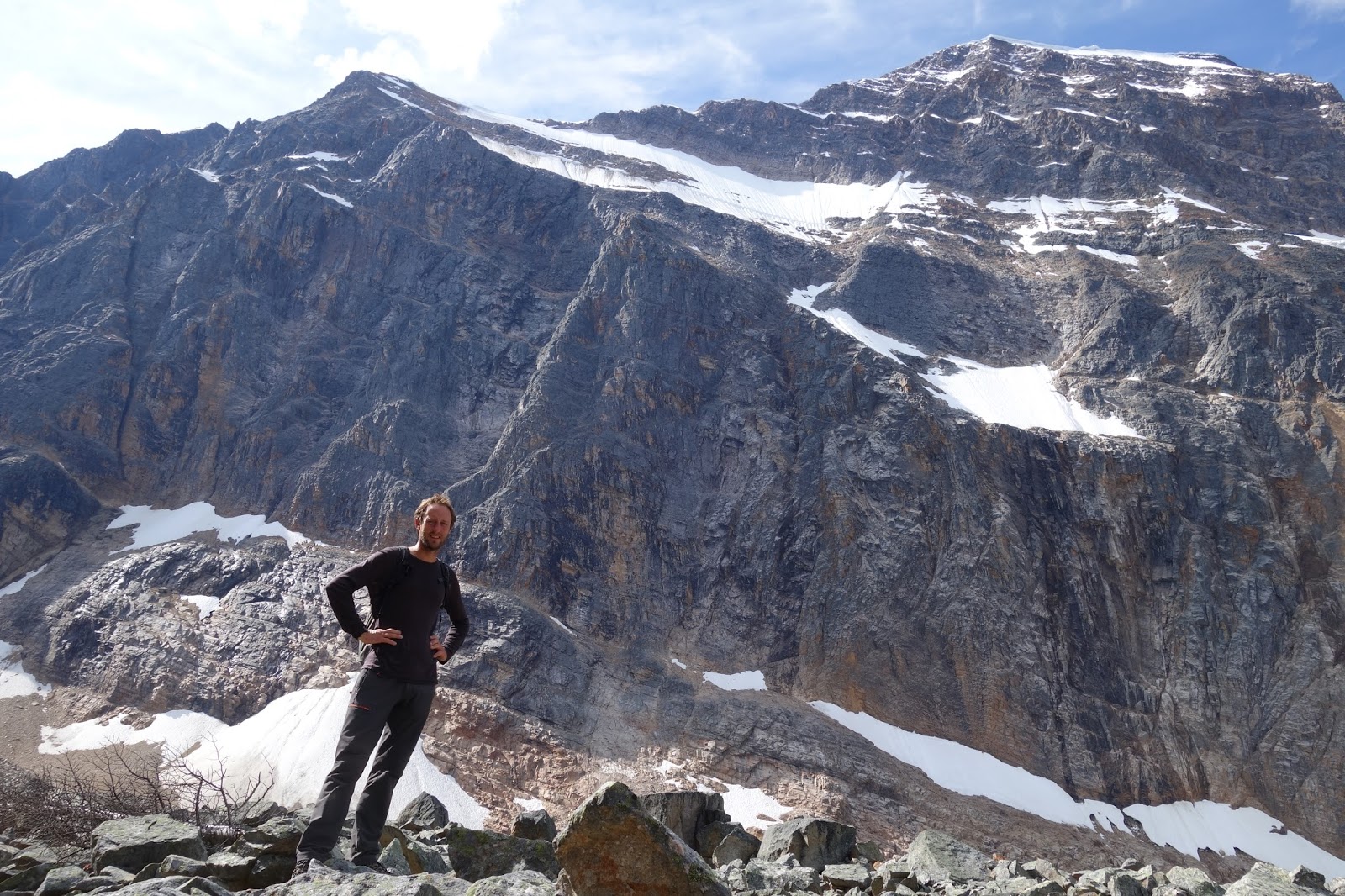
We tooled around on some super easy sport climbs and finally were rested and ready to tackle our next, and last climb of the trip, the east ridge of Mt Edith Cavell (III, 5.3, 11,034'). 

The mountain dominates the Jasper skyline and is considered a easy route in dry conditions, and a excellent moderate mixed route when snow is present. We hiked into the base the day before our ascent to check it out, and it certainly was in mixed conditions, with clearly lots of snow on the ridge, and giant cornices hanging on the summit ridge. 


Mt Edith Cavell, our route ascends the ridge line to the left. 


Kyle below the east face of the mountain
I had been to the base of the mountain about 6 years ago, and was shocked by the changes I saw. The lake below the hanging glacier had quadrupled in size, and a large portion of the glacier had fallen off. Anyone who does not believe the climate is warming should visit the Rockies every few years, and see the vanishing ice. 


Climate change in action. Disappearing glaciers.

The next day we woke up at 3:30 am, chowed down some coffee and breakfast then drove to the trailhead. We were there a little bit before 4:30 am.


Alpine start

It took about an hour to traverse the moraine and then we climbed a steep snow slope to gain the col and the start of the ridge. We started up the ridge, which involved steep 3rd class scrambling on loose rock. We then gained a snow couloir, put the crampons back on, and followed it to more rock. The weather was great, and we enjoyed the early morning light.


Snow couloir

On the ridge. Quality rock?

Contemplating where to go

Awesome views

We were not alone on the climb, another pair of climbers were very close to us for most of the route. Very nice guys, a young guy from Michigan, and an older guy from the Okanagan who we had actually met in the Bugs the week before. It was nice to have a bit of friendly company on the route.

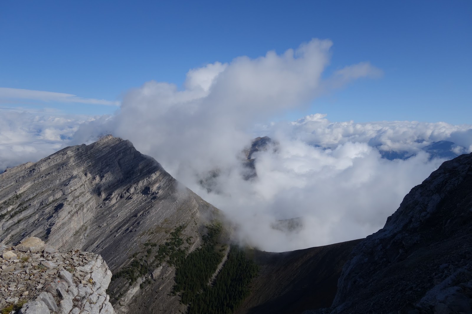
We continued up, as we got higher on the ridge, clouds began to coalesce on the summit, eventually obscuring our view of the mountain. 


Our last views of the summit before the clouds came in


Whiteout forming
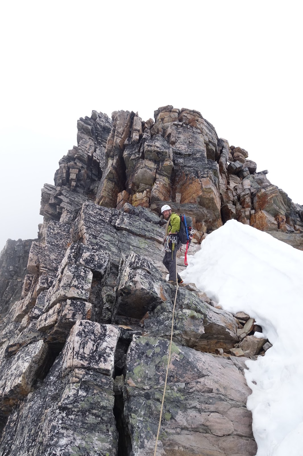
By the time we reached the crux rock pitch it was a total whiteout, and we could not see anything. We headed up the 60 meter crux pitch, which had the best rock on the whole mountain, rock solid quartzite, almost as good as granite.


Rock quality is improving
Above the rock crux we still had over a thousand feet of ridge to climb in the cloud. As we got higher the amount of snow increased. Eventually we were sitting below the east summit which was guarded by an overhanging cornice. 
Climbing into the whiteout.
Above the cornice, we reached the long summit ridge. It was covered in cornices that were hanging over the east face. Amazingly some tracks led near the edge of the cornices, super dangerous. We travelled the ridge, staying as close to the ridge proper as possible, in case one of those snow cornices decided to peel off!


Travelling the summit ridge


See the overhanging cornice above Kyle's axe?
We found the main summit! Our companions took a nice summit shot of my brother and I.

Brothers on the summit!

Then the long descent down the west ridge and around the mountain. This involved descending thousands of feet of loose scree and talus. Ugh.

At least the views were nice, and the clouds cleared as we lost elevation.

ice axes are good for scree as well
Looking back towards the summit
Views on the way down
Almost through the talus on the way down. Notice the now clear skies.

We headed back to town for some food. Then it was back to Calgary and home.

Such an awesome trip, the climbing was out of this world, and it was so great to do it with my brother! Looking forward to some rest, and then my next adventure!