Last year while on a ski tour in the Alps I met the owner of Powder Mountain, a Heli-ski operation based in Whistler. He invited us all to come down for a couple of days of Heli-skiing. What a cool experience. He even had a professional photographer tag along (Duncan Sadava). Here is a sample of some of the excellent photos he took of us on a blue-bird heli-ski day. I'm the guy in red :)
Fresno Climber
Just an average guy enjoying his free time in the mountains
Tuesday, March 3, 2026
Wednesday, June 5, 2024
Tokopah wall - Snow Boots - 3 star adventure with 1 star climbing
I met with Christopher for a day of adventure climbing in Sequoia National park. Chris is one of those special few climbers who enjoys a solid bushwhack and isn't afraid of a bunch of hiking to get out climbing. My kind of guy. We saddled up to give the moderate adventure "Snow Boots" on the Tokopah wall a go.
The approach takes the pleasant and popular Tokopah falls trail out of Lodgepole. We hiked to the end of the trail, past the Watchtower right to the falls themselves.
![]() |
| The mighty watchtower |
![]() |
| Tokopah falls |
From the falls it was a short and bushy scamble up to the base of the slab/wall. From the trailhead I believe it took us somewhere in the range of 2 hours. Finding the start of the climb was surprisingly easy. Chris headed off and we swung leads up the wall for a total of 7 pitches. The climbing on the first 5 pitches was very easy, nothing harder than 5.6, and we quickly dispatched those.
![]() |
| Chris heading up a nice moderate crack on P3 |
![]() |
| Big comfy ledge at the top of P5 |
The last 2 pitches were the only parts of the climb that had any real climbing. Pitch 6 started out with a short beautiful hand crack, which quickly gave way to a wide low angle crack (reminiscent of some 5.8 off-widths in Yosemite). As the pitch progressed, the crack became increasingly wet. Eventually it was rather difficult to avoid the wetness, and my shoes were soaked. Placing your feet on wet granite with wet shoes is rather exciting.
![]() |
| Looking down from the top of P6 |
![]() |
| P7 - the crack was very wet inside! |
The top of P6 was a semi-hanging belay in a puddle. This made exiting the belay rather difficult, luckily we had packed two #4 cams, so despite the slipperiness and wetness we always had reasonable pro.
We found are way to the summit and enjoyed some snacks, and excellent views of Alta peak and the Watchtower.
![]() |
| wonderful views |
![]() |
| Christopher on the summit |
We had vague instructions on the walk-off to descend down the Horse creek drainage. We expected a heinous, difficult descent, but it really was not all that bad. It only got bushy near the bottom of the drainage. It was fairly obvious where to go, and was pretty pleasant for most of it.
![]() |
| Christopher eyes the way down |
![]() |
| A bit bushy at the bottom, not too bad |
Back at Lodgepole we hit up the store and grabbed a beer! Luxury! A great day out with a competent, fit and adventurous partner.
Wednesday, May 15, 2024
Shastina and Mt. Shasta - Ski Descents
For my 44th birthday (geez, I'm getting old) I put some of my new found love of ski touring to use and heading out for a 3-day ski mountaineering trip to Mt. Shasta with Ted.
I had previously climbed and summited Mt. Shasta 3 times, once from the north via. Hotlum-Bolum ridge, and twice by Casaval ridge. For this outing, we opted to head to the more obscure Hidden valley (9200') to set a base camp to climb both Shastina (12,335', 3rd highest Cascade volcano) via cascade gulch, and Mt. Shasta (14,179', 2nd highest Cascade volcano) by the west face.
![]() |
| Shastina - Our ascent and descent routes |
![]() |
| Mt. Shasta - our ascent and descent routes |
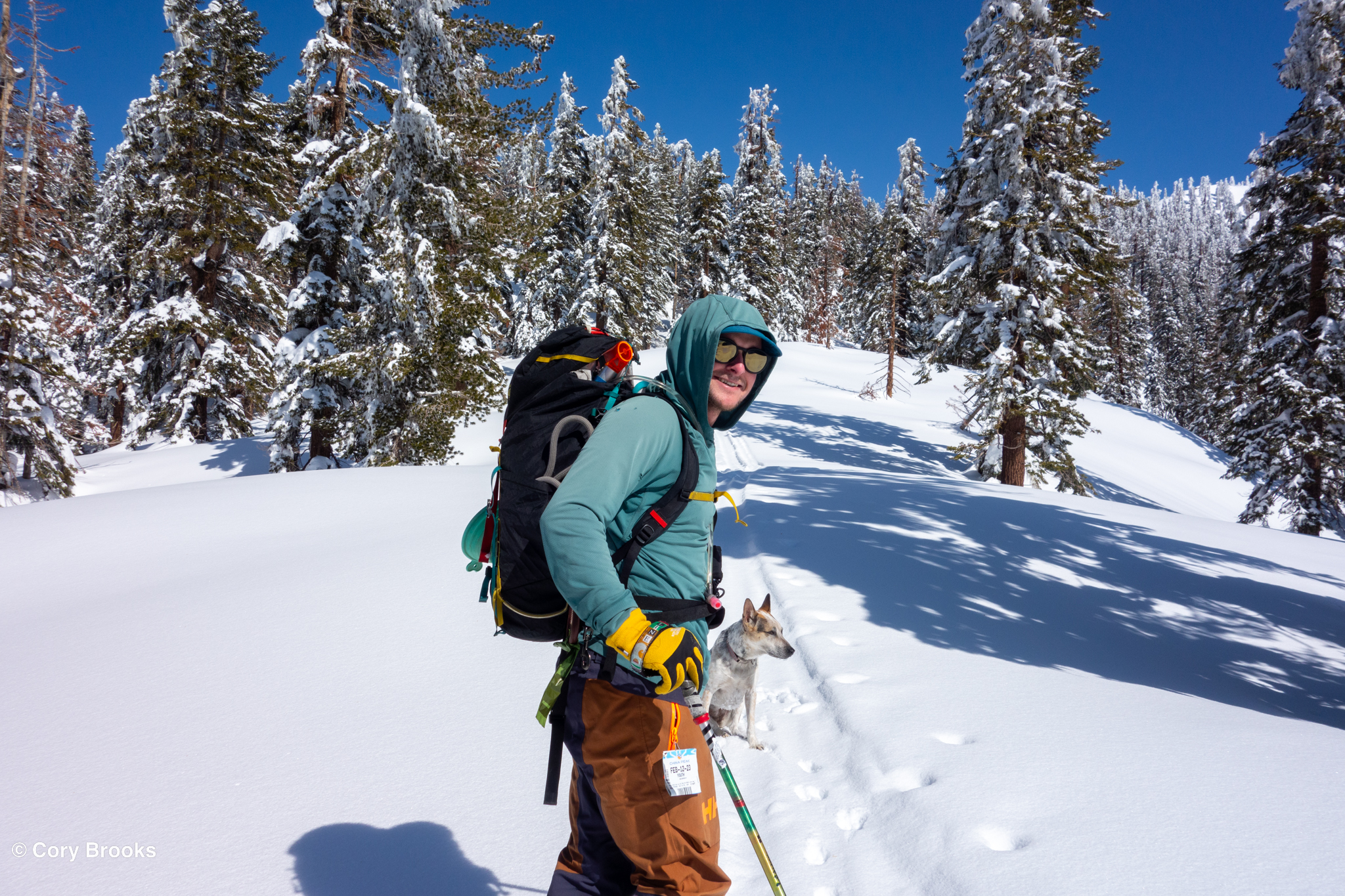
We opted for a 3 day itinerary, mostly because i) I am out of shape, ii) I know my body needs time to acclimate. Classes ended on May 10th, and I had a few days before giving exams, so we drove up May 11th, arriving at the Bunny flat trailhead around 1 PM. It was HOT, summer is arriving in California.
![]() |
| Ted's ready to go at the Bunny flat parking lot |
Its a ~ 4 mile ski with ~2500' of elevation gain to reach the camp site at Hidden valley. The approach starts on the standard avalanche gulch approach and then veers up and west around the toe of Casaval ridge at Horse camp. It was hot, the snow was slushy, and it was slow going with heavy packs
![]() |
| Ted on the approach to hidden valley |
![]() |
| Crossing a gully on the way to hidden valley |
We reached hidden valley maybe 3 hours later (slow indeed!). Found a nice spot to pitch our tent and enjoyed the sunshine. There were 2 more parties camped at hidden valley, a group of folks on foot, and what appeared to be a guided ski party of 3. We lounged around, ate, melted snow for water and slowly acclimated.
![]() |
| Ted relaxes at camp |
![]() |
| Home sweet home for 3 days |
For the first day we aimed to climb and ski Shastina, the smaller subpeak of Mt. Shasta. Sitting at just over 12,000' it seemed like a logical choice for a day of acclimatization. Being a shorter objective, we were able to wake up fairly late (around6 am) and starting skinning up cascade gulch around 7-7:30 AM.
![]() |
| skinning up low angle terrain |
![]() |
| On the summit crater. Mt. Shasta in the background |
Shastina was a nice ski tour, no need for crampons or ice axe. I was able to either use ski crampons or skins for the entire ascent (~3,000' from camp). The only time I carried my skis was to walk around some steep rock towers to find the true summit of the mountain. We found our way to the summit, and then skied off the top.
![]() |
| Near Shastina's summit |
We had a wonderful ski descent on corn! Super fun! We were back to camp by 1:30 PM, and settled in for a long relaxing afternoon of resting, re-hydrating and eating at camp. We were in bed by 6 PM, and tried to sleep
We woke up a 2 AM for our ascent of the Mt. Shasta west face, and were on route by 3:00 AM. It was a cool, clear evening. The snow was firm and icy, so we opted to carry our skis and boot the entire face in crampons. It was a slow plodding ascent, we reached the top of the west face around 8:45 AM.
![]() |
| Top of the west face |
We rested for about an hour,. We left the skis at the top of the west face, and then began the traverse along the crater towards misery hill and the true summit of Shasta (about another 1000' of elevation gain). By this time we were both pretty tired, and feeling the altitude, so it was slow going.
![]() |
| Looking back towards the top of misery hill |
We made it to the summit in less than 2 hours, and didn't linger as I was anxious to begin skiing before noon.
![]() |
| Approaching the summit |
We retraced our steps and made it back to the top of the west face in about 30 min
![]() |
| Re-hydrating before the descent |
Skis were put back on, and down the west face we went, a 4000' drop back to camp. The top of the face was steep (40 degrees) and quite icy. I was an first nervous the descent was going to suck, but we skied across the wide face and as got lower found some fantastic corn snow. What a blast! As we approached the lower third of the face we traversed way back across and dropped into a bowl on the other side of the face
![]() |
| Getting ready to drop into the lower bowl |
We found spectacular corn snow. Wat a dream, I was giddy, so much fun! Overall it took us about 7 hours 8 hours to summit and return to the top of the west face and about an hour to ski back to camp. We rested in camp for a while, then broke it all down, and skied back to the car. We were in town, enjoying my birthday meal at the Black Bear diner by 3:30 PM.
What a great trip! Thanks to Ted for being my partner on this great little adventure Ski mountaineering is certainly fun!
Saturday, October 28, 2023
First ascents - new sport routes
Myself, the boys and my lovely wife have been busy putting up a series of new routes out at a crag. It's a bit of hump to get up to the crag, so carrying 60 lbs of bolting gear up and down that big hill has made for some slow new routing. That being said, we have put up a handful of fun new climbs which add to the large amount of development that Mr. Doe and others have been up to over the past decade. Once word is out, this whole area will be a premier climbing spot in the Western sierra.
![]() |
| Ted on the FA of Summer Rain (5.10-) |
Monday, July 24, 2023
Dogtooth Peak (again)
Griffin hit me up wanting to do some sort of alpine venture. I could only do a day trip, so suggested we climb Dogtooth Peak, since it's an easy day trip. I had climbed the peak twice before, once as a first ascent with Kevin, and a second time I climbed the NE arete with Trevor (although we were actually trying to climb Lookout, but went up the wrong thing!). This time I proposed we climb "Lookout"
![]() |
| Overlay of routes on Dogtooth peak. |
I met up with Griffin at the Cliff Lake parking lot at 7am and we headed off. With all the snow melt the normally tame creek crossing required taking our shoes off and wading through knee deep water. Cold on the feet!
![]() |
| A little wet |
After a quick easy 2.5 hour hike we found ourselves at the base of the tower. We didn't really look at the topo or beta very carefully and sort of thought we were looking at the correct route so scrambled up a couple hundred feet to what we thought was the start of the climb.
![]() |
| scrambling up to the 5th class terrain |
We roped and racked up, and then I spied a bolt on the face directly above us. At that point I was fairly certain we were not on the correct route! Anyway, I headed up anyways, I figured it didn't really matter much. After a rope stretching easy pitch, I found a bolted anchor with chain! Definitely we were not on Lookout!
We swing leads and continued up, finding a bolted anchor station every 60 meters. The climbing was easy, but became progressively harder and more interesting as we went higher.
![]() |
| Griffin approaching the top of P4 |
Griffin led the last pitch, he headed out and then found the crux above. A steep off-width type flake loomed above to gain a ledge. He decided to break up the last pitch and belayed me up off a gear anchor so we could look at the last bit togher. With a big cam (#5 or 6) it would be protect-able, but all we had with us was a #4.
![]() |
| Heading out on the last pitch |
![]() |
| Offwidth flake crux |
Griffin pull through the crux without any gear (bold!), I'm glad I didn't have to lead that one! After that it was easy cruising to the saddle below the summit. We scrambled up to the summit, and then headed back to the car for some ice cold beer!
After some sleuthing on old ST posts, I believe we climbed the route "Gin and Juice" (5.9, 5 pitches, FA Matt Schutz and Julie Tran, 9/2017). Enjoyable climb, now I just need to back one more time and actually climb "Lookout"
Thursday, July 20, 2023
Learning to backcountry ski
2023 has been a slow year adventure/climbing wise. There have been a bunch of reasons for it. After returning from Greece, I found that my stoke and psych for climbing had been a bit low. However, with the record breaking snow this year, I finally took the plunge and bought a backcountry ski set-up. I had a ton of fun being a novice again and learning how the whole ski touring thing works
I did a bunch of solo tours on Black Butte, near Huntington lake, which was great for learning. The drive and approach are short, there is very little avy danger, so it was the perfect place to learn!
![]() |
| Top of Black Butte - looking down on Huntington lake |
![]() |
| Fresh turns in the silky powder on the north facing slopes of Black Butte |
I only did a couple of bigger tours, both in Kaiser peak area. The firs bigger one was Ted up to Potter Pass. The uphill was pretty easy, skinning is not very difficult and is certainly an efficient way to travel. The problem came on the downhill. The guys at REI had not quite adjusted the heel gap on my binding properly so one of my skis would not stay on! Yikes! 7 miles and 2,500' of elevation to descend was not easy!
![]() |
| Ted using my skin tracks as we head up Potter Pass |
![]() |
| A snowy landscape around Huntington Lake |
![]() |
| Just to the west of Potter pass. We skied down the drainage to the left |
On a second ski trip I went back to Kaiser Peak with Griffon, this time we took the main Kaiser peak trail, which was much steeper. We found tons of fresh deep powder, and with my binding repaired the ski went much better! I'm looking forward to getting a bit more into ski touring next winter!
![]() |
| Griffon and Shasta |
![]() |
| Deep powder |
![]() |
| Virgin powder on the slopes. Backcountry skiing is fun! |


