Tuesday, June 12, 2018

Denali (20,310') - West Buttress

"You know those things you've always wanted to do?  You should go do them"

 When I started climbing mountains a few years ago, I dreamed of trying one of the great peaks in the world. I thought, maybe I should  climb Denali, the tallest in North America at 20,310' (6190 meters) and arguably one of the most challenging of the 7 summits. 

This June I met that life goal.

I spent a total of 20 days in the Alaska Range climbing the West Buttress of Denali. The experience for me was the culmination of 6 months of difficult training and focus, and was a truly unique life experience. 

 
Denali!


The mountain is climbed capsule style. A series of camps are established on the peak while carrying hundreds of pounds of gear, and leap-frogging it up the mountain. I climbed the West Buttress route, which is by far the easiest route, being non-techincal (although not totally a walk-up either). 

I had originally hoped to climb it self-supported with a group of friends, but that fell through, so I decided to go with a guide - The American Alpine Institute.

West Buttress route of Denali. Photo credit - Alaska Mountaineering School
 I took over 400 photos over 20 days, so I am going to try to whittle this blog post down to a handful of words and images to try and capture the whole experience. Its rather difficult to write about, and the pictures don't to the place justice. I cannot suggest enough that all climbing and mountain enthusiasts should tackle this great mountain once in their life. The experience won't leave you the same, I promise.

The trip began in Anchorage, Alaska. There I met up with the climbing team, 3 guides and 9 climbers. By far the biggest group I have ever climbed with. We loaded up a van and trailer with our gear and drove about 3 hours North to the town of Talkeetna, the tiny town that is the staging area for the mountain. 

Loading up.
 Once we were in Talkeetna, we headed straight to the private airport and K2 aviation's hanger. In the hanger we organized and sorted the hundreds of pounds of climbing gear, food, fuel and so on.

Sorting gear in the hanger
 In the late afternoon we helped load up 2 Otter airplanes with gear, boarded the plane and headed off for the glacier. 

Otter plane - equipped with skis for glacier landing
 
On our way!
The planes fly by sight only (no instruments!) so if there is any issues with visibility, the planes turn around. Our first flight into the glacier encountered thick fog, turning the pace around and back to Talkeetna. Later in the day, we tried again, this time with a successful landing on the glacier at base camp (7,200').


Landing at Base camp.
 The plane was unloaded, and a camp set-up. This was the start of 20 days in another world of snow and ice. 

Building camp
 The next day, we broke camp, loaded sleds and carried everything to Camp I (7,800'). Although not very far (6 miles) and not much elevation gain, it was actually one of the hardest days on the whole trip as we carried all of the gear in one shot. My sled has about 80 lbs in it and my pack had about 60 lbs. Heavy loads!

Loading the sleds

Traveling on the glacier
 We set up camp I, then the work began. For the next week or so, the way our days would go would be
1. Carry a load up somewhere below the next camp bury it.  
2. The next day, move up to the next camp
3. The next day , retrieve the gear below the camp
 repeat steps 1-3. 

Up until camp 3 (~ 14,000') the terrain is pretty mellow. Just a low angle glacier with the occasional steep hill. The weather was great for the most part. Sunny and warm during the day. We only had one day of snow, at camp 2, a good 3 feet dumped on us, but was didn't slow progress.
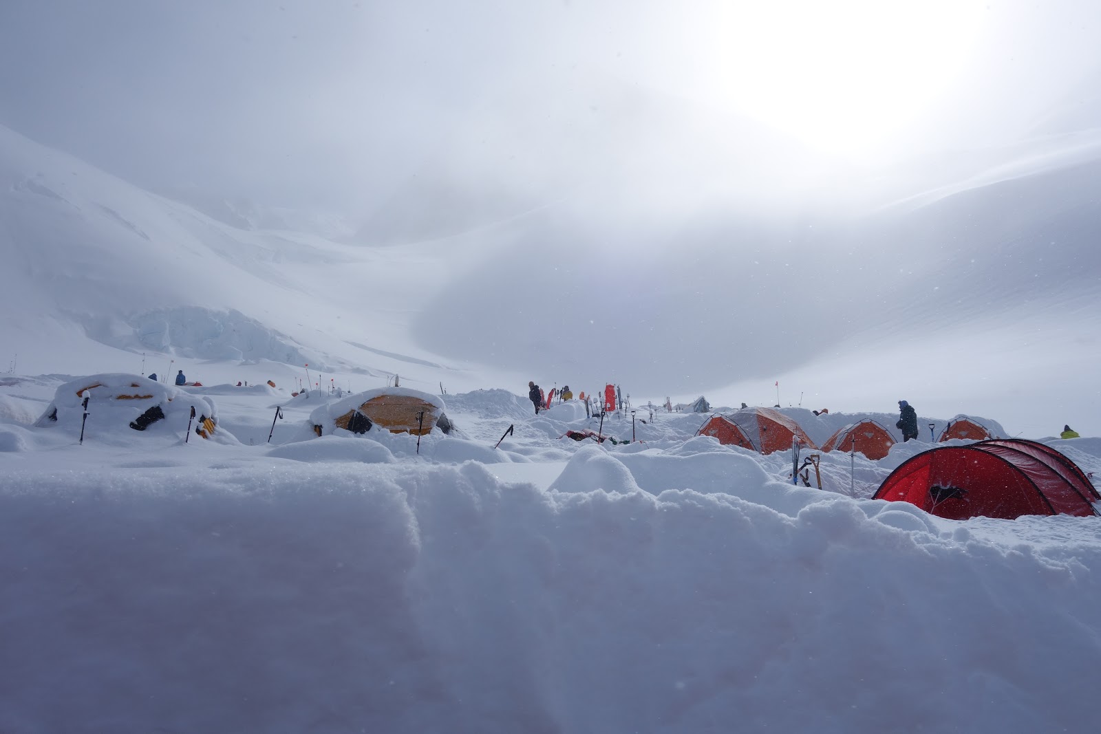
Fresh snow at Camp II (~11,000')
 
Burying gear in a white out

 On the lower glacier, the sun is intense. Even a few minutes of exposure can result in sever sun burns. To manage this, I wore a Patagonia sun hoody, glacier glasses, a baseball cap, a buff, a ridiculous looking nose guard combined with huge amounts of sun screen. The result, is that I looked very funny. Good thing I was on a glacier with a bunch of other dorky looking people!


Glacier sun protection = weird fashion statement
Over a week after starting, we rolled into the camp 3 at 14,000'. This camp is really where the mountain begins. The rolling easy glacier gives way to the steep upper mountain, and the camp itself becomes a mini tent-city with hundreds of climbers being there to climb a variety of routes or ski the mountain.The views from the camp are also spectacular. 


Our tents at camp 3
Views from Camp 3.
We built ourselves a nice wall of ice blocks, and settled into the rhythm of life at camp 3. 


Our wall
The "nights" (the sun does not actually set, just goes behind mountains) were extremely cold, dropping down to - 16F (-27 C) some night. We retrieved a gear cache one day, did a training day another, and then had a rest day. 

Life was interesting,  we had a cook tent dug out, where we enjoyed awesome meals (Pad Thai, Mac n' cheese, back country pizza, pancakes, I even had a variety of meat substitutes like tofurkey sausage). 


Cook tent
We dug and walled in a bathroom area. Here there was a "pee hole" in the snow, and a plastic bucket provided by the National park service, called a CMC (clean mountain can) is used for solid bodily waste!


Jaime demonstrates how to use the bathroom facilities
Denali toilet system - The clean mountain can (CMC) in all of its glory. 12 people would use this thing at once....

After these 3 days we started in on moving up the upper mountian. Above camp 3 there are 800 feet of fixed ropes which are climbed using jumars. This leads to a col, and a narrow ridge which ends in a flat glacier and camp 4 at 17,000'. 

On a frigidly cold morning, we carried some gear to be buried up the fixed lines to the col at 16,000'. This was possibly one of the coldest days on the trip, one of our group even got frost bite on his fingers, and I may have sustained a cold related injury on my feet (more on that later).

At the col around 16,000'

So cold I had to wear my expedition parka and big mitts
We then dropped back down to Camp 3, and remained stuck there for a few days due to extreme cold higher up and high winds. At that time, 3 of our group quit, and headed back down the mountain.

We entertained ourselves at Camp 3 by listening to podcasts, going to the weather board at the climbing ranger camp and taking short hikes to gorgeous views. 


The weather forecast board
Some of the views from the short hikes were not so bad...
Eventually the forecast improved, so we packed up and moved camp up the fixed lines to the high camp at 17,000' (camp 4). This was one of the harder days, carrying 50+ lb packs up steep fixed lines. However, it was also one of the more enjoyable parts of the climb as there was a long narrow ridge, at times only a few feet wide. The views were spectacular. We were very lucky, and had a gorgeous, warm sunny day for the move. On the move we also ran into Colin Haley, perhaps North America's top alpinist. Very cool.

Colin Haley - Notice his tiny backpack!
 
Moving on the ridge


Looking back at the fixed lines (see the obvious track with the tiny people!)
I'm excited to take a break
Always stunning views
A narrow section of the ridge
We arrived at Camp 4, pitched our tents. Living up there is hard. Its cold and exposed to the winds. We ended up spending 4 days there due to weather. But on the day of our arrival it was beautiful, so I had the chance to wander around and take a bunch of pictures.

Camp 4 at 17,000'
 
Looking down at Camp 3 from 17,000'. Its like a mini tent city


Looking at the ridge - see the climbers?
We had 2 tent -bound days of bad weather. Sunny, but windy and bitterly cold (~ -20F; -30C). We then made a summit bid, but got turned around due to extreme wind at Denali pass. We were super bummed.

We tuned into the radio forecast at 8 PM that night: -25F and 30 MPH winds. We went to bed thinking that the summit was not going to be ours.


We woke up to calm, sunny and warm weather! So we loaded up the packs, and made a blast for the summit. The weather was spectacular. Our lead guide told us, that in 14 summit bids he has made, this was the warmest one! Lucky us!


Its actually pretty easy going to the summit. Only 3,000' of elevation gain, a lot of it on very moderate, mellow terrain. The only hard section, is the autobahn, a 1000' hill our of Camp 4 which has running belays. After that, smooth sailing. 


The autobahn is the tracked hill in the back. The only hard part of summit day
Mellow terrain above the autobahn
After about 5 hours we reached the final summit ridge. Excitement was building. We were going to make it!


The final summit ridge!

When we topped out, I can't begin to describe the feeling. I have spent the past 6 months training more than 15 hours a week. I have dumped thousands of dollars into this goal, and I have had a almost singular focus on achieving this single moment. Its a exhilarating experience to have put so much energy into something and then reach it. What a moment. 


The rest of my team approaching the summit
Jay and I reached the summit first. So had a few moments to hoard the glory

 
Group summit photo!


This is what it looks like at the top of North America!
We made a hast descent. On the way we ran into Colin Haley again, having completed the speed record on the Cassin. We also ran into Chantel Astorga and Anne Gilbert Chase who had just completed the first female ascent of the Slovak Direct. Very cool, a lot more bad-ass than climbing the West Buttress!

We spent a night at Camp 4 and then descended the ridge. Unfortunately, everyone else on the planet was descending at the same time and the ridge was a bit of a shit-show. Luckily we were still high from having reached the summit, so did not mind too much.  

Heading down the ridge

chaos on the way down.
 We spent another night recovering at camp 3 (14,000') before dropping all the way back to basecamp in a single overnight push.

Night descent. Sometime around 2 AM
 When we arrived at base camp, we hastily pitched our tents, and dug out some well deserved cached beer!

Well deserved beer!
 The next morning, we queued up with others clamoring to get back to civilization, and loaded up the glacier planes

Everyone is ready to go home. Our guide enjoys a morning beer (right)
 
Load the planes. lets' go home!
When we arrived back in Talkeetna, I bought a one way ticket to LAX, and caught a bus to Anchorage. About 36 hours later I was back in Fresno.


The whole experience was almost surreal.  I suffered some minor nerve damage to my toes (maybe trench foot), which will hopefully heal soon. At the start I was unsure I was up to the challenge of spending 20 days in a tent on an arctic mountain, but I relished the whole experience. I'm already plotting my next big peak expedition. Who wants to join me for some suffering?

Sunday, May 6, 2018

Mt. Silliman - Training Hike

Its getting close, I leave for Denali in 10 days. I'm finishing up my training plan, so I headed up to Mt. Silliman - with a 60 lb pack on. 

 
Start of the hike!

The trail is easy going for the first few miles. Once reaching Silliman creek and a mileage sign I headed odd the main trail up into the cirque below Mt. Silliman.

This is where you head off trail
 Reaching the cirque, I had beautiful views of great cliffs that bracket the west ridge of Mt. Silliman. One day I am going to put a route straight up the slab into the beautiful crack system above. 

Unclimbed face on the West ridge of MT. Silliman
 The class 2 rock slabs that guard the approach to Silliman lake were mostly snow covered, which actually made the going a bit easier than normal. The lower part of the slabs were melted out with streams of water coming off them.


Water on the slabs
Snow covered slabs
I ditched the water jugs for the last 500 feet or so, and headed up to the summit.


Looking back on the west ridge


I signed the summit register, and saw a familiar name. 

I might climb this peak too often!


Some summit selfies, then back home!

Summit selfie

Saturday, April 28, 2018

Visting scientist -- Rock climbing blitz

Last summer in Peru my tent mate was Dr. Jeff Garvin, a physiology professor from Case Western University in Ohio. We hit it off, being kindred spirits of sorts. He was in San Diego for the Experimental Biology Meeting, and made a detour up to Fresno to give a talk at the University. Being a good host to a visiting scientist, I brought Jeff on a tour or some of my favorite local moderate multi-pitch rock climbing venues.

First off, Fresno Dome. We climbed the South Pillar (II, 5.7), Whiskey Bill (II, 5.8) and one of the sport climbs at Hawk Dome.

High up on the South Pillar of Fresno Dome - so good!
 The next day, we headed up to Sequoia National Park to climb the South Face of Moro Rock. Its one of my favorite climbs, 7 pitches long, and very high on adventure. It starts with a heinous bush-whack down a gully to the base.

Jeff on the approach
 I had climbed the route last year, but this time I had the pleasure of leading the entire climb. Beautiful. It has some run-outs, and exposed, committing moves. Its truly a magnificent climb.

Looking down from the top of one of the crack pitches
 We had a great time!

Castle Rocks in the background


Jeff at the end of the technical pitches.
We took a rest day (i.e. Jeff gave a talk in the Chemistry department) and then on our last day Teresa joined us, and we headed over to Shuteye ridge. We enjoyed another long moderate multi-pitch route on Chiquito Dome, then some fun sport climbing on El Grande, a beautiful 5.10 route. The sun was out, there was only 2 other climbers (on a very fun looking 5.11 -- now on my tick list). What a great way to end our trip

Teresa - at the top of Chiquito Dome

Climbers on Constellation

Me on the lower section of El Grande
 It was really nice to have Jeff visit, he's really a kindred spirit. I hope he visits every year!
 

Saturday, April 21, 2018

Mt Shasta - Casaval Ridge solo

Mt. Shasta is really one of my favorite mountains for spring climbing. It has over 7,000 feet of elevation gain, most of it on a highly enjoyable ridge. Well consolidated snow, great views and short bits of exposure make it one of the more enjoyable routes on the mountain. 

Mt. Shasta's Casaval ridge. - Photo credit - Mt Shasta Avalanche Center
 I had climbed the route last year with Mitchell, but we were forced off the ridge due to some rock fall. So this time, I wanted to complete the entire route.

I drove up Friday night, and slept in the parking lot at Bunny Flat. I woke up around 7, and had a leisurely start.  I dropped my tent about 2000' up the ridge at 10 am, and then headed up to try and do the entire route in a day.

Morning view of Mt. Shasta from Bunny flat. Casaval ridge is to the left.

I by passed a large group also camping on the ridge, maybe a guided group? They had a massive tent that slept about 8 people!

Tent on the ridge
 Eventually I arrived at the steep traversing section of the ridge, with many gendarmes. A very interesting section of the climb.

Starting on the ridge proper
 
Steep traversing section


One of the many gendarmes on the ridge
After many hours on the ridge, I eventually crested the rim arriving at the summit crater. This part of the climb is the worst. Going from sea-level to 14,000' is rough. You think you are done, but then you have to go up one more big hill, and then a long flat section, then another short hill to reach the true summit. This last section would only take an hour if I had been acclimated, but I was sick, nauseous and feeling the altitude, so it took me at least 2 hours.

Misery hill. Ugh. The last section on the crater before reaching the true summit (back).
 I reached the summit, and descended Avalanche Gulch, then traversed back to my camp on the ridge. It took me about 12 hours from car-to-camp. Not fast, but reasonable given my lack of acclimitization.

A fun summit, and a good training run for Denali, which is coming up very quickly....

Saturday, March 31, 2018

Training and Hiking in Powell River

Teresa wanted to visit her parents, so we packed up the car, and our little dog and made the 20+ hour drive up the west coast of North America to her home town of Powell River.

Welcome to Powell River
 Powell River is located north of Vancouver, and although its on the mainland is separated from Vancouver by 2 ferry rides. There is no road connecting the town to the mainland because of large inlets and the rugged coast range. 

That is a long drive....
 Our drive up the I5 was uneventful, and we made a single non-stop 19 hour push all the way to the town of Gibson, north of Vancouver. We could not make all the way to Powell River in a single day because of the Ferry schedule. 

The next day we loaded up onto the final ferry and made our way.

Powell River ferry pulls into the dock
 In addition to the typical family visiting, I managed to get in some Denali training. Right out of my in-laws back-yard is access to a section of the Sunshine Coast Trail (SCT) which includes a small and rugged hill called Scout Mountain. This made for some nice trail runs!

Powell Lake from the summit of Scout "mountain"
 
Summit bench overlooking the town of Powell River
My nieces and brother/sister in-law came up for a visit mid-week, the kids are growing fast. I was of course a bad-influence on them, getting them highly over-stimulated.


Trouble makers
 Teresa and Penny joined me on some hikes in the region. The higher elevations were still holding snow, and things were very wet, but we had a great time hiking around on sections of SCT.

Hiking old logging roads in the BC rainforest
Adventure dog prepares for a creek crossing
Log crossing
On one of the sunnier days, I decided to give one of the local coast range mountains a crack - Mt. Freda, one of the taller mountains in the range, but sitting at only 6500' above sea level. I thought it was going to be easy, but I was mistaken!

Summit bowl of Mt. Freda
I woke up bright and early, navigating 20 miles of active logging roads. The spur I was supposed to drive up off the main-line was buried in snow, so I had to park an extra few miles back from the trailhead. Good thing I packed the snow shoes!
Parked, packed up, ready to go.
Road is snowed in!
On the snow shoes went! I easily located the trail head and started up the very steep, timbered slopes. The going was very slow. The snow was deep and fairly unconsolidated, so I was sinking even in snow shoes. I got lost several times in the woods. The route winds its way up a steep, densely forested slope, before reaching a mellow, increasingly lightly forested ridge. Once on the ridge, the snow was even deeper and more powdery, making things even slower than back in the forest!

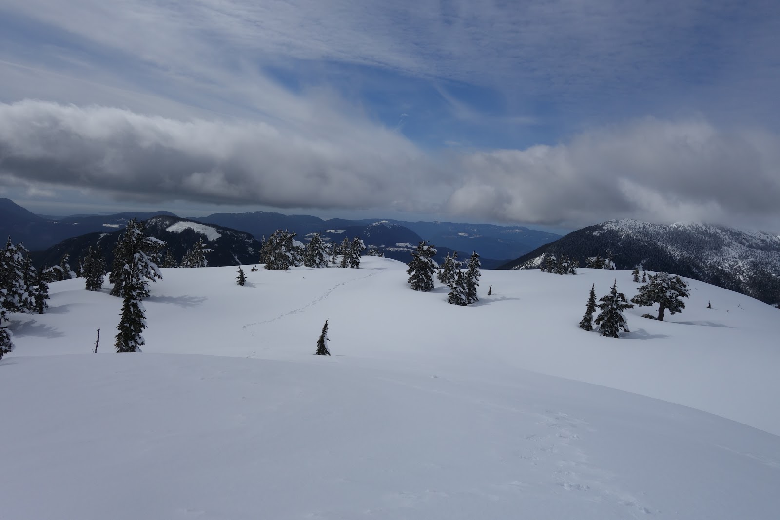
traveling in deep snow. The summit of Mr. Freda above

 
Looking back on the mellow ridge


Eventually I popped above the treeline, finally reaching the base of the actual summit climb.

I was unsure the best route, as the main face looked prone to avalanches, so I wandered around a bit, before finally settling on heading towards a corniced ridge off the main face.


Where did I come from?
 I was about 800 feet from the top when I reached the base of the corniced ridge line. It look somewhat dubious, and was intermittently going into a white-out. That combined with the lateness of the day (I was going to be late for diner with the family!) I decided to head back down, - summitless. It has taken WAY longer than I was expecting, 7 hours to climb 4000' -  sheesh! So I turned around and retraced my steps back down

Views on the descent.
I made it back to the car in 3 hours, and just barely made it back for diner!

A fun little trip, one of these days I need to spend more time in Powell River, but in the summer, so I can better explore the excellent alpine terrain, and the many rock climbing opportunities!